From The Cliff Mass Weather Blog
Friday, October 25, 2019
Looking at the latest forecast model output reveals a scary situation developing over northern California for late Saturday and Sunday, where strong, dry offshore winds will provide a major wildfire hazard.
PG&E will have little choice but to de-energize a large portion of its system, blacking out hundred of thousands of customers.


NASA MODIS satellite image of the Kincade Fire (north of San Francisco) yesterday around noon
The set up is classic, and the first sign of the event is passing through Washington State at this very moment. An upper level trough is moving southward overhead, with cold air and higher pressure sweeping into Washington State. By tomorrow morning (see below) the cold air and high pressure will be at the Oregon/California border (green, while and blue colors are colder temperatures). Note the large change of pressure at the leading edge of the cold air, such a large change in pressure means strong winds.
The situation Sunday morning (see below) is extremely concerning. The cold air has strengthened and moved east and south, creating very large pressure gradients, and thus strong winds, over the Sierra Nevada and northern California. The perfect set up for strong easterly/northeasterly dry winds over the region…known as Diablo Winds. I have an NSF grant to study these winds and have written a few papers on the subject…so this is of great interest to me.
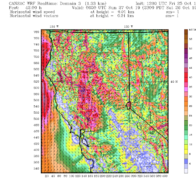
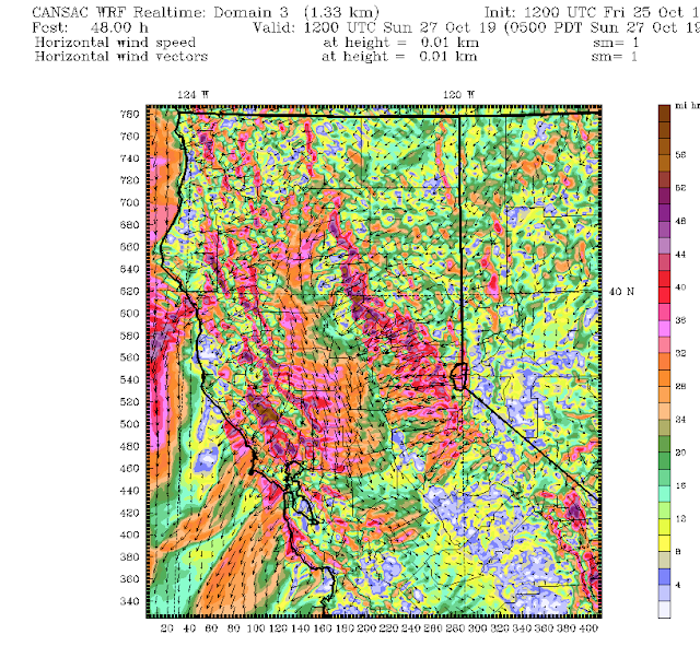
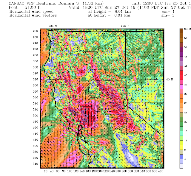
Let’s look at the latest high-resolution WRF model forecasts over northern CA made by the Desert Research Institute CANSAC group. This figures will show sustained winds–gusts are 30-50% larger.
The event begins around 11 PM Saturday, as strong northerly winds push southward into the Central Valley and easterly winds begin to rev up on the western slopes of the Sierra Nevada.
Six hours later, all hell is breaking loose. Sustained winds of 50 mph or more are found on the western slopes of the Sierra Nevada and on/downstream of some of the higher crests of the terrain north and east of San Francisco (such inthe Sonoma County area in which the Kincade fire is burning). The strong winds are found in regions of acceleration associated with mountain waves.
The serious situation continues at 11 AM Sunday, perhaps even stronger.
During the subsequent hours, the strong winds begin to decline, but will be strong enough to maintain fires that have already started. During this event, gusts will certainly reach 70-80 mph in favored regions. Humidities will be very low.
PG&E will have little recourse but to de-power a large region and that must include the high-voltage, high tension towers. A failing tower caused the Camp Fire last year and appears to have initiated the Kincade wildfire this week.
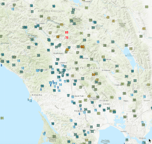
One good thing is that PG&E has added hundreds of surface observation sites that provide an extraordinary view of the winds in the region. To illustrate, here is the maximum gust map for Thursday, north of San Francisco. Lots of observations–and you can see the strong winds (75 and 80 mph) associated with the Kincade fire. Not how winds change very rapidly in short distances. Very valuable.
via Watts Up With That?
October 26, 2019 at 12:48PM


