
Travel will be very difficult if not impossible.
National Weather Service Aberdeen SD – 1155 AM Sun Dec 29 2019
…BLIZZARD WARNING UNTIL MIDNIGHT TONIGHT…
…WINTER STORM WARNING FROM MIDNIGHT TONIGHT TO NOON MONDAY…
For the Blizzard Warning, additional snow accumulations of 3 to 5 inches. Winds gusting as high as 55 mph. For the Winter Storm Warning, additional snow accumulations of up to two inches. Winds gusting as high as 45 mph.
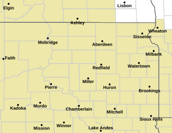
* WHERE…Portions of central, north central and northeast South Dakota. Including the cities of Herreid, Pollock, Eureka, Leola, Aberdeen, Richmond Lake Rec Area, Indian Creek Rec Area, Mobridge, Cravens Corner, Ipswich, Pembrook Colony, Plainview Colony, Bowdle, Deerfield Colony, Loyalton, Gettysburg, Hoven, Burkmere, Faulkton, Norbeck, Redfield, Cow Creek Rec Area, Okobojo Creek Rec Area, Onida, Stephan, Highmore, Ames, and Miller
* IMPACTS…Travel will be very difficult if not impossible. Areas of blowing snow will significantly reduce visibility. The hazardous conditions will impact the Monday morning commute.
* ADDITIONAL DETAILS…Intermittent white out conditions are being reported in open areas.
Thanks to Kenneth Lund for this link
The post Blizzard warning for High Plains appeared first on Ice Age Now.
via Ice Age Now
December 30, 2019 at 09:17AM
