
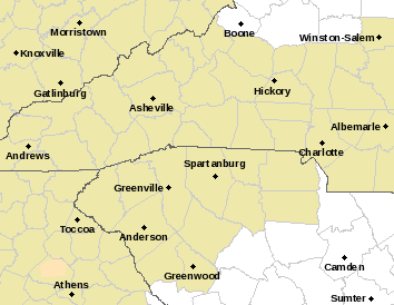
Winter storm warnings until 7 pm this evening. Three to six inches of snow. Locally higher amounts possible.
URGENT – WINTER WEATHER MESSAGE
National Weather Service Greenville-Spartanburg SC – 8 Feb 2020
ACCUMULATING SNOW TO IMPACT EXTREME SOUTHERN APPALACHIANS IN NORTH CAROLINA…SOUTH CAROLINA…AND GEORGIA TODAY
The highest snow accumulations will likely occur near the junction of the Georgia,
North Carolina, and South Carolina borders in the extreme southern Appalachians.
Including the cities of Clayton, Pine Mountain, Mountain City, Cornelia, Demorest, Clarkesville, Hollywood, Franklin, Rainbow Springs, Kyle, and Highlands
* WHAT…Heavy snow. Total snow accumulations of 2 to 4 inches, with local 5 inch amounts near the North Carolina border.
* WHERE…Rabun and Habersham Counties in extreme northeast Georgia and Macon County in western North Carolina.
* IMPACTS…Accumulating snow on area roadways, and reduced visibility in snow, could make travel very difficult.
PRECAUTIONARY/PREPAREDNESS ACTIONS…
If you must travel, keep an extra flashlight, food, and water in your vehicle in case of an emergency.
………………
URGENT – WINTER WEATHER MESSAGE
National Weather Service Peachtree City GA
Murray-Fannin-Gilmer-Union-Towns-Pickens-Dawson-Lumpkin-White-Cherokee-Forsyth-Hall-Including the cities of Dahlonega, Cleveland, and Gainesville
* WHAT…Heavy snow. Additional snow accumulations of two to four inches. Total snow accumulation of three to six inches with locally higher amounts possible.
* WHERE…Portions of north central, northeast and northwest Georgia.
* IMPACTS…Travel could be very difficult.
* ADDITIONAL DETAILS…Accumulating snow on area roadways, and reduced visibility in snow, could make travel very difficult.
Temperatures should drop below freezing again tonight…making black ice possible on Sunday morning.
……………….
National Weather Service Morristown TN
Including the cities of Shooting Creek, Brasstown, Hayesville, and Tusquitee
* WHAT…Periods of moderate to heavy snow expected. Total snow accumulations of 2 to 4 inches.
* WHERE…Clay County.
* IMPACTS…Plan on slippery road conditions.
PRECAUTIONARY/PREPAREDNESS ACTIONS…
If you must travel, keep an extra flashlight, food, and water in your vehicle in case of an emergency.
Thanks to Kenneth Lund for this info
The post Heavy snowfall for North Carolina, South Carolina and Georgia appeared first on Ice Age Now.
via Ice Age Now
February 8, 2020 at 10:44AM
