Month: September 2024

Largest of the Saved Clams, Part 3. Inaugural Megafauna Expedition, September 2024

In May 1992, and again in March and April 1993, the Royal Australian Navy, specifically HMAS Tarakan, was involved in the translocation of tens of thousands of clams as part of Operation CLAMSAVER.  The clams were moved from a successful breeding program at Orpheus Island to various locations on the Great Barrier Reef, including to Grub Reef.

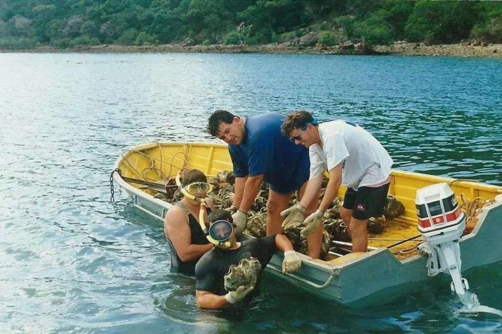
I am grateful to Jon Daly for providing me with some photographs from that time.

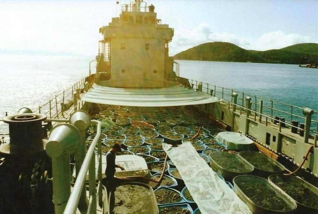
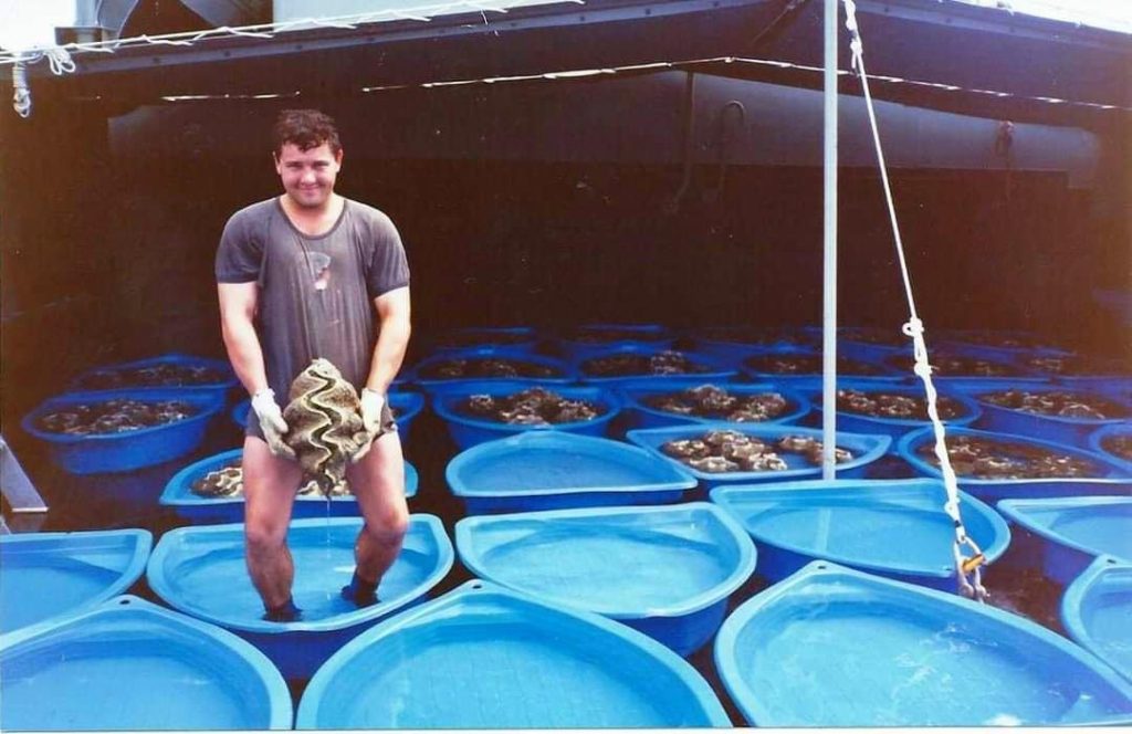
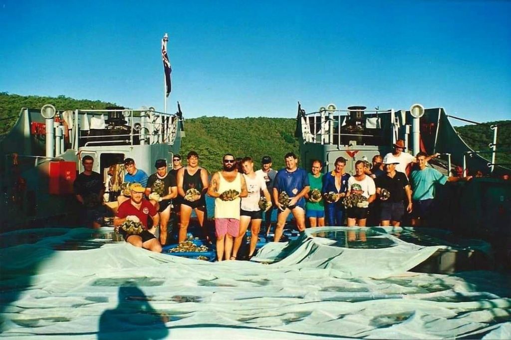
Daly wrote: “The guy in second from top photograph is Paul Livermore …  photograph of Tarakans tank deck covered in cheap plastic scallop shaped children’s paddling pools a continuous spray from the ship’s fire main …  I’m in the blue t-shirt, in two of the photographs … . [end quotes].  And I have more notes from other conversations with Jon Daly, for another time.

There appears to have been little if any follow-up, to know the fate of the clams.

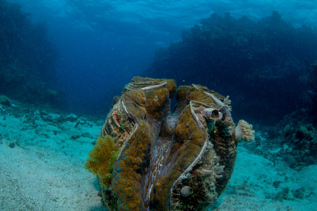
Considering the photographic evidence from Jon Daly, the clams were not much more than 30cm in length when they were moved.    How big are they now?

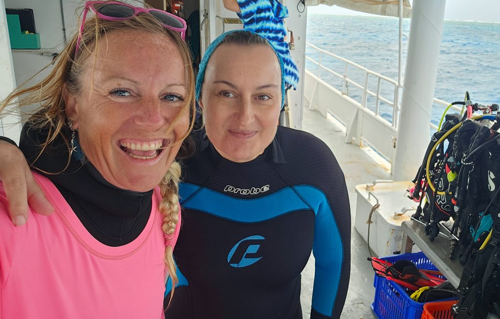
As part of the inaugural Megafauna Expedition – with the charter of the MV Sea Esta funded by Sydney-based philanthropist Simon Fenwick – we set off for Grub Reef on Wednesday, 4th September.

The skipper, Paul Crocombe, did some careful research and reconnaissance in advance of the expedition and was able to find one of the translocation sites for us.

Somehow, despite the blustery conditions, strong surface current and the ever-present risk of colliding with a one of the many bombies within such coral reef systems, Paul got the MV Sea Esta into Grub Reef and close to one of the translocation sites.

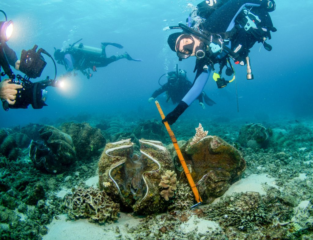
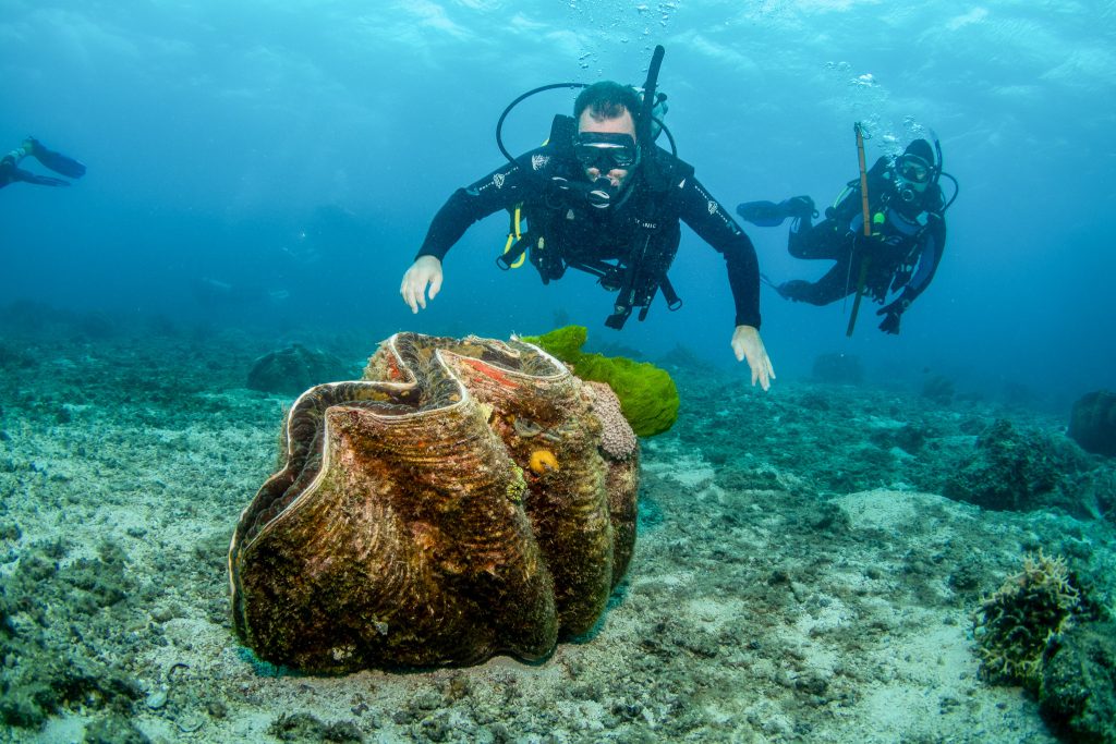
Underwater photographer Jenn Mayes with her scuba buddy Nadine Huth found and filmed the largest clam at 1.47 metres.  Congratulations!

Jenn Mayes (in pink) with her buddy Nadine Huth on the dive deck of the MV Sea Esta.

Winning photograph by Jenn Mayes with Nadine Huth holding the metre long ruler, in the category ‘largest clam’. The same clam is shown in the feature photograph at the very top of this blog post, and also below.   This is one of the clams saved by the Royal Australian Navy as part of operation CLAMSAVER.

There is so much more to tell, about that day and how it unfolded, giant clams, even a whale shark encounter for Dave Armstrong but without a photographer to capture the memory, and provide the evidence.

This story will be continued, including as part of a documentary film in production and about the inaugural Great Barrier Reef Megafauna Expedition.

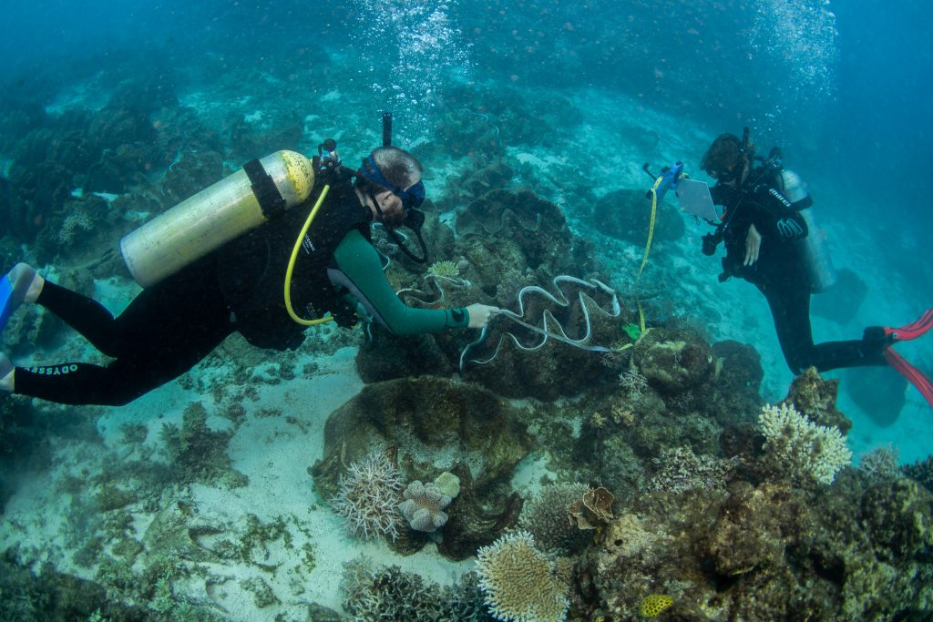
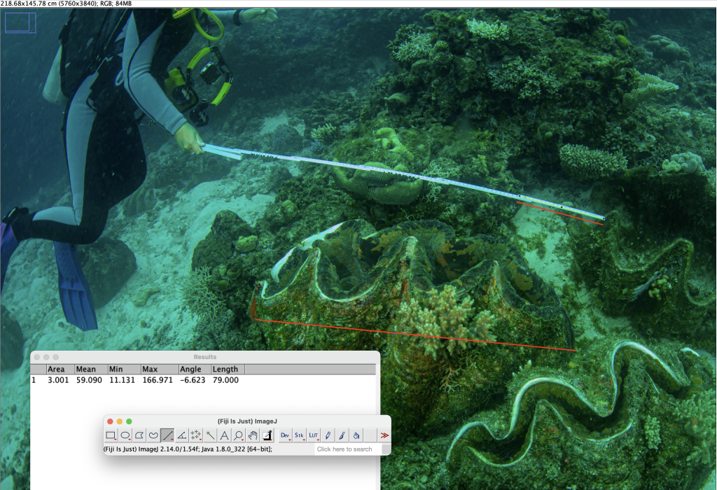
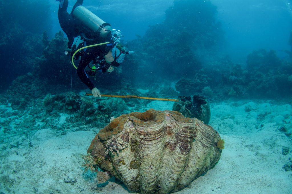
Rick Braley asked that we measure some clams, and we did.  There was a tape measure, and various other yardsticks being used by the expedition team.   The mean length of the clams measured on the first dive with the tape measure was 1.11 metres (n=6), and on the second dive was 0.91 (n=8).   These clams are all likely to be from the one cohort translocated from Orpheus Island.

Good job Dr Braley and the Royal Australian Navy!


via Jennifer Marohasy

https://ift.tt/W2EC6By

September 14, 2024 at 06:19AM

More Horror Pictures Emerge Showing Locations of  Met Office “Extreme” Record Temperatures

From THE DAILY SCEPTIC

by Chris Morrison

These days the Met Office has rebadged its daily “high” temperatures as “extreme”, all the better of course to ramp up fears of heat as part of the Net Zero education process. Last Wednesday’s “extreme” of 20.4°C was recorded at Teddington Bushy Park. As the Google Earth photo below shows, the “extreme” temperature is helped on its way by an adjacent high wall reflecting heat onto the measuring device and a large housing development warming the nearby area. Teddington Bushy Park is a junk class 4 station with internationally-recognised “uncertainties” of 2°C. Joke class 4 station might be a more apt description. How anyone can think information taken at this site is suitable for scientific work that ultimately produces a global mean temperature is a mystery.

Under a classification system set by the World Meteorological Organisation (WMO) that takes account of temperature corruptions, natural and unnatural, 77.9% of Met Office sites are rated class 4 and 5 and have uncertainties of 2°C and 5°C respectively. The Met Office does its best to explain away the poor siting of most of its UK-wide 380-strong temperature station network. Class 3 – uncertainties of 1°C – and class 4 are said to produce “valid high-quality data”, something that might be in dispute by looking at the Teddington photo. The WMO is said by the Met Office not to preclude the use of data from super junk class 5. For its part, the WMO states that a class 5 is “where nearby obstacles create an inappropriate environment for a meteorological measurement that is intended to be representative of a wider area”. Nearly one in three (29.2%) of the Met Office’s sites are rated super-junk 5 and from this, apparently, the Met Office can produce average temperature figures to one hundredth of a degree centigrade.

Earlier this year, a freedom of information request from the Daily Sceptic finally revealed what has been suspected for a long time, namely that the Met Office temperature measuring system is not fit for the purpose of providing accurate measurements of temperature either at specific local sites or at national and global average scale. To date, the Met Office has not made an official statement on the growing concerns that surround its scientific work following the startling revelations. It does however produce an occasional remark that suggests it is hiding from the implications of the growing criticism. Last June it declared the highest, pardon, the most extreme temperature so far of the summer at Chertsey, another ‘record’ that came under question when it was revealed that the measuring device at Chertsey water pumping station was surrounded by a newly-built solar farm.

This is the solar farm in question and it surrounds what appears to be the temperature measuring station. To be fair to the Met Office, Google Maps puts the station a few yards away – there are sometimes small errors in precise placing of any location. But what is not disputed is that the site is next to a large solar farm with over 1,800 panels. Solar panels generate large amounts of heat in the nearby areas with scientists suggesting warming of 3-4°C. Citizen journalist Ray Sanders recently tackled the Met Office on the Chertsey location and the state-funded weather service admitted it was “aware” of the solar panels near its station. “The temperature measurements meet standards for publication and scientific use,” noted the Met Office.

Over in the United States, meteorologist Anthony Watts has spent decades investigating the temperature output of the local weather service NOAA. He recently presented evidence to show that NOAA’s temperature data was “fatally flawed” with an astonishing 96% of 4,000 plus measuring stations corrupted by poor placement. As in the U.K., many photos of unsuitable locations have been published. The one below from a site in Florida showing measurements taken near a bank of air conditioning units is a particular horror show.

Appearing on a recent Tom Nelson podcast, Watts was asked about the 40.3°C runway record temperature declared for 60 seconds on July 19th 2022 as jets were landing at RAF Coningsby in the U.K. He pointed out that such events were caused by new electronic measurements that reacted to temperature change within one tenth of a second. The previous mercury thermometers took much longer to move and would never have picked up temporary temperature movements caused by gusts of wind or passing jet aircraft.

All of these figures are collected and then adjusted and the “bottom line” is that the data have been changed to increase the warming trend. A number of attempts have been made to estimate the changes caused by numerous corruptions. “We have about 50% less global warming than the media and activists would have you believe”, Watts suggests.

Chris Morrison is the Daily Sceptic’s Environment Editor. The image at the top of this article shows the location of the Met Office temperature station at Aberdeen Dyce International Airport. No further comment required!

via Watts Up With That?

https://ift.tt/rKXlTjC

September 14, 2024 at 04:06AM

Sahara desert hit by extraordinary rainfall event — suggested link to ‘subdued’ hurricane season

Sahara desert
A clue may be that ‘the ITCZ [Intertropical Convergence Zone] has shifted north this year, over the northern Sahara’, but uncertainty remains. The unexpectedly low activity of this hurricane season (Talkshop post here) has put a spanner in the works for many climate pundits, now hunting for possible reasons.
– – –
An unusual deluge of rain is hitting the Sahara, one of the driest regions on Earth, says LiveScience.

It’s unclear exactly why the desert is experiencing so much rain, but it could be connected to an especially quiet Atlantic hurricane season, scientists say.

The rain is so heavy that some usually dry regions of North Africa are now experiencing monsoons and flooding, with parts of the Sahara predicted to see five times their average September rainfall.

Precipitation in the Sahara overall is not completely uncommon — the region is huge and diverse, and some parts often receive small amounts of rain, Moshe Armon, an atmospheric scientist at the Federal Technical University (ETH) Zürich, told Live Science.

But now larger portions of the Sahara are being inundated, including areas further north where it’s usually drier, Armon added.

Some scientists suggest this is part of Earth’s natural climate fluctuation, while others say it’s a product of human-induced climate change. “The answer is probably somewhere in between,” Armon said. [Talkshop comment – just an opinion].

This climatic shift in the Sahara may be connected to a weaker Atlantic hurricane season. This year’s hurricane season has been quiet so far, despite predictions early in the summer of severe hurricane activity due to high ocean temperatures.

Meteorologists noted this was the first Labor Day weekend in 27 years without a named storm forming in the Atlantic.

Over half of named storms and 80% to 85% of major hurricanes in the Atlantic each year usually come from the region just south of the Sahara, Jason Dunion, a meteorologist at the National Oceanic and Atmospheric Administration (NOAA), told Live Science in an email.

During a typical hurricane season, atmospheric waves move off the western coast of Africa and into the North Atlantic Ocean, along what’s called the Intertropical Convergence Zone (ITCZ) — a belt circling close to the equator, where air from the Northern and Southern hemispheres meets.

The ITCZ belt can carry clouds, rain and storms. The atmospheric waves carried west along the ITCZ over the Atlantic, combined with warm Atlantic waters, develop into tropical storms and hurricanes.

But part of the ITCZ has shifted north this year, over the northern Sahara. Scientists are not completely clear why this is happening now, although climate models have previously predicted the ITCZ will move north due to ocean warming, and warmer air temperatures, as carbon emissions heat the Northern Hemisphere faster than the Southern Hemisphere.

The effect of the current northward shift is that the ITCZ pushes rain further north in Africa than usual — across the Sahara — while those atmospheric waves from Africa are also displaced north of their usual path. Without ITCZ moisture moving over the warm Atlantic, the ingredients aren’t all there for severe storms to develop.

Full article here.
– – –
Image: Sahara desert from space [credit: NASA]

via Tallbloke’s Talkshop

https://ift.tt/SbqV7gv

September 14, 2024 at 04:04AM

Cippenham Sewage Works DCNN 5101 – Well at least it’s Flat.

51.50685 -0.64274 Met Office assessed CIMO Class 4 (?) Installed 1/1/1961 but daily temperature records only archived from 2017

It is beyond any level of gullibility to accept this can possibly meet CIMO Class 4. No doubt if I were to ask the Met Office to justify their assessment (as per Chertsey Abbey Meads) their response would be millimetre accurate measurements from the nearest sewage settlement tank to the Screen or calculations of exactly what percentage of roadway falls within a 10 metre radius etc.

What does CIMO Class 4 actually stipulate?

The suggestion that all those sewage treatment tanks (with contents well above ambient air temperature) associated buildings, standing water, process units, roadways and vehicles have no immediate effect and are typical of the surrounding area is somewhat risible. Cold weather can seriously slow down sewage treatment plant’s operating efficiency. Remedial actions to overcome this problem routinely include artificially raising temperatures in the storage tanks and operating systems.

The proximity of major roads (M4 Motorway) and artificial watercourses (Jubilee River) rather pales into insignificance compared to the completely unnatural nature of the site’s surroundings. The urban area of Slough to the north has increased by 50% since the turn of this century, Heathrow and West London are just to the east and Windsor to the south.

Although the Met Office records indicate installation in 1961, temperature records only run from 2017. Is this yet another “convenient” effectively modern site chosen to take readings only ever likely to record artificially enhanced temperatures? Electricity sub-stations, solar farms, walled gardens, zoological gardens, airports and now sewage treatment plants – the list of modern sites in highly compromised locations is growing longer – and there are many more to report on coming soon.

Whilst Rothamsted is an example of how to correctly site a weather station to the best practice, Cippenham Sewage Works exemplifies exactly where not to locate weather stations whose data contributes to the historic temperature record.

via Tallbloke’s Talkshop

https://ift.tt/xv63c4A

September 14, 2024 at 03:53AM