New Study: 21st Century Megadrought In The SW USA Caused By 45 Years Of East/Central Pacific Cooling

Climate models failed to simulate the observed 1970-2014 Pacific Ocean cooling. The 21st century southwestern US megadrought has been linked to this cooling, which “may have been caused by a forced response to greenhouse gas emissions.”

A new study provides a fresh look at the circular, self-contradictory reasoning that proponents of the anthropogenic global warming (AGW) narrative routinely employ.

The authors acknowledge that the Central and East Pacific region has been cooling since 1970, and that climate models failed to simulate this cooling. The modeling failure stems from the assumption that rising greenhouse gas emissions lead to warming, not over four decades of cooling.

“While AO-GCMs [climate models] predicted a warming SST trend in the Central and East Pacific, the region instead experienced a cooling SST trend from 1970 to 2014…”

After insisting that “internal atmospheric variability has a larger role than SST forcing in explaining SWUS [Southwestern United States] precipitation variance,” and that “most historical droughts are unrelated to SST [sea surface temperature] forcing,” the authors nonetheless pivot, explaining that only during recent decades is the SWUS megadrought causally linked to SST forcing.

“In this study, we confirmed the connection between the Equatorial Pacific SST trend pattern and SWUS precipitation trends with Green’s function approach, which allows us to establish a causal link between SST and precipitation.”

But the SST forcing that suddenly explains recent SWUS drought trends (after not explaining these trends historically) is not the sign expected with rising greenhouse gas (GHG) emissions. No, drought has not been caused by warmer SSTs, but cooler SSTs. They say warmer SSTs will lead to a wetter climate, or less drought.

“…a cooling SST trend from 1970 to 2014…which potentially led to the observed megadrought in the SWUS due to a decrease in precipitation.”

“If the Central and East Pacific continue cooling, a prolonged period of drought is more likely to continue in the SWUS.”

However, in the future, warmer East and Central Pacific SSTs due to rising GHGs are expected (according to modeling) to cause less precipitation, or more SWUS drought. So over 40 years of cooling explains drought now, but sometime in the future warming will explain drought…even though neither warming or cooling SSTs explained SWUS drought historically.

“At least part of the megadrought was related to a lack of precipitation from the cooling Central and East Pacific, rather than due to a significant increase in evapotranspiration from global warming, which will likely cause droughts in the future as anthropogenic climate change worsens.”

But it’s worse than we thought. The authors assert the cooling SSTs causally linked to the 1970s-to-present SWUS megadrought – but that may not be the cause of drought in the future – may be explained by – yes, indeed – rising GHG concentrations. GHG forcing leads to warming SSTs – which, again, may not cause drought now, but may in the future. And yet the recent decades of cooling SSTs may be a response to the rising GHGs too. Rising GHG concentrations may simultaneously cause warming SSTs and cooling SSTs.

“The cooling of the Central and East Pacific not simulated by AO-GCMs [climate models] may have been caused by a forced response to greenhouse gas emissions.”

So let’s review what the authors found with a “Plain Language Summary” of own.

Until recent decades, internal atmospheric variability explained historical trends in drought. Warming or cooling SST trends did not. Then, in recent decades, a cooling SST trend (1970-2014) has been “confirmed” as the causal link to the SWUS megadrought. In the future, however, warming SSTs may cause SWUS megadrought. And both the warming and cooling trends in the SWUS are (and have been) caused by the same mechanism: rising GHGs.

It would appear the modern version of what constitutes peer-reviewed “climate science” has devolved into something resembling more of a creative writing exercise than actual science.
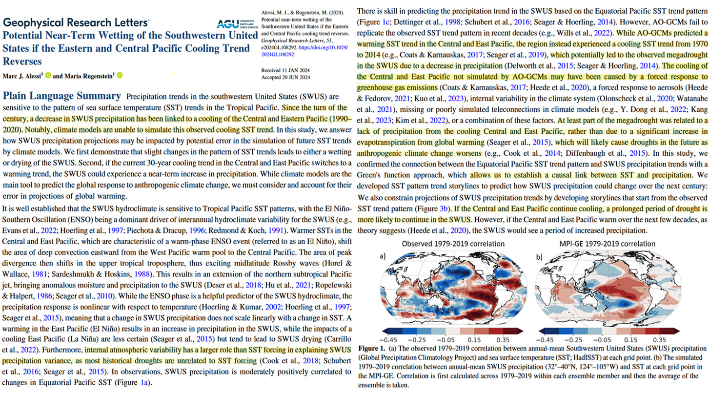
Image Source: Alessi and Rugenstein, 2024

via NoTricksZone

https://ift.tt/NAaGLFt

September 16, 2024 at 05:16PM

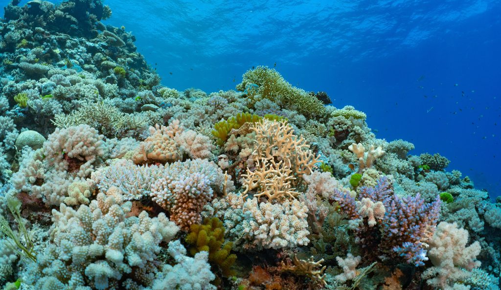
Diving the North Wall, Myrmidon Reef, Part 4. Inaugural Megafauna Expedition, September 2024 

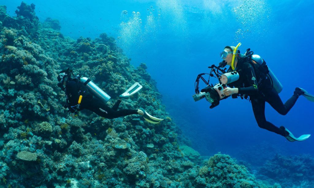
I am yet to dive the North Wall at Myrmidon.  As part of the team onboard the MV Sea Esta I was deck hand, even holding Laura Boderke’s underwater camera, as she waited.  Leaning backwards from a rail at the back of the boat, waiting for First Mate Robert to yell the instruction, ‘Go. Go. Go’.  As the Skipper cut the engine, I passed the camera across, Laura simultaneously fell backwards into the big swell – into the South Pacific Ocean, on the outside edge of Myrmidon Reef that is beyond the Great Barrier Reef proper.

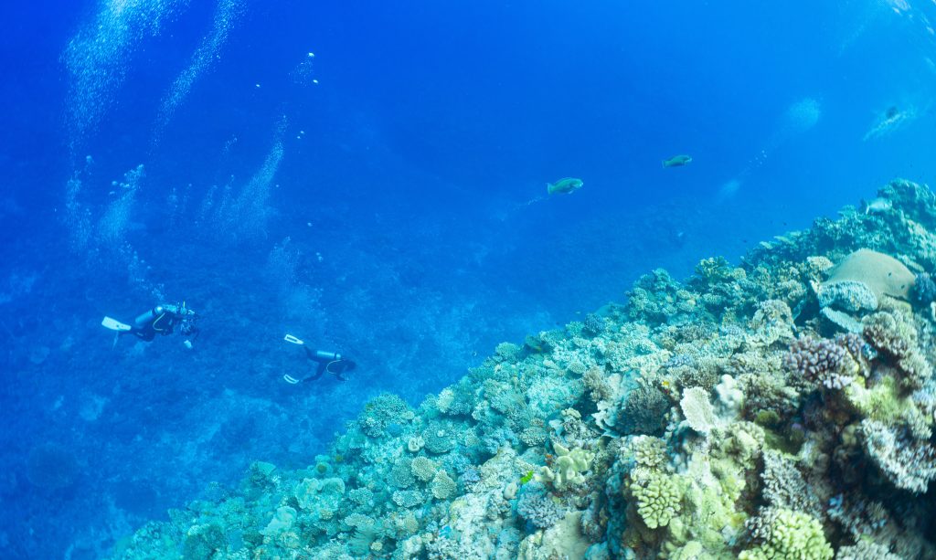
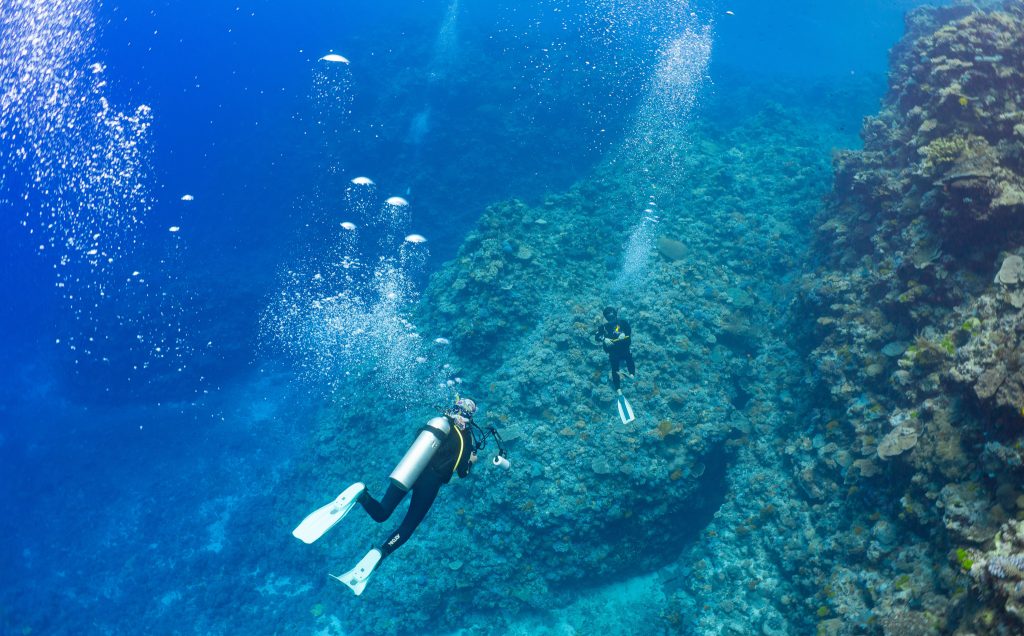
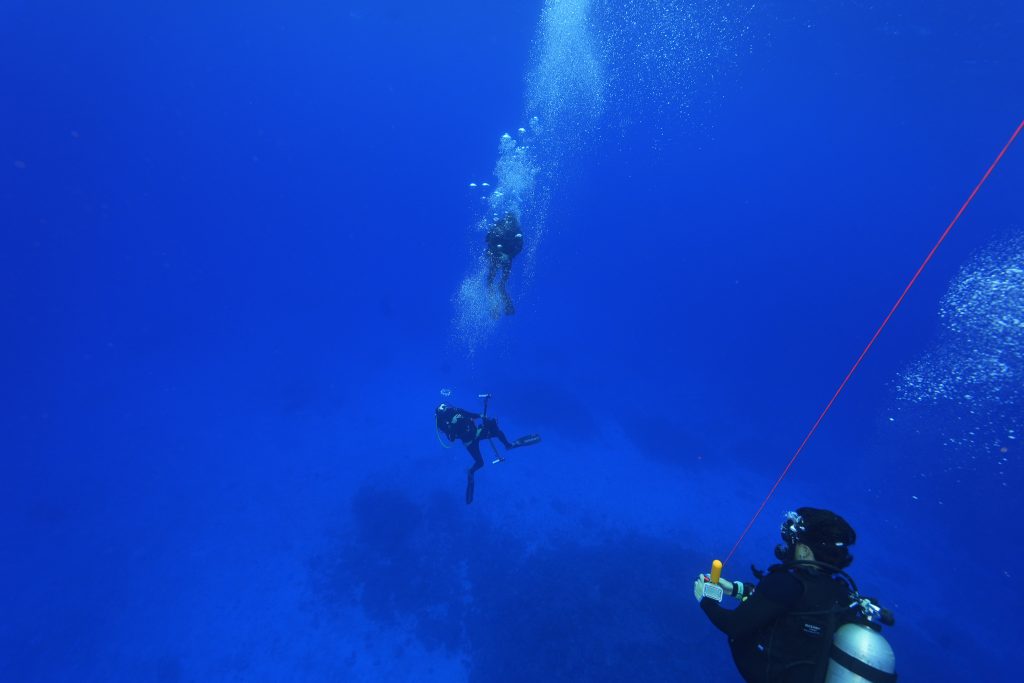
Down. Down. Down they went – Laura, with her scuba buddy Sebastian Falk and Stuart Ireland with his scuba buddy David Armstrong.

So much thanks to Stuart for all the photographs – so we can know what they saw.  He is a truly awesome underwater photographer and cinematographer.  And as greedy as a boy in a sweet shop with a mouth full of milk bottles he has posted so many of these magnificent photographs across at his Facebook page, ‘tis here: https://www.facebook.com/stuireland

Meanwhile I would like to organise an exhibition of the best photographs from our four days at sea – from the inaugural Megafauna Expedition to the still magnificent Great Barrier Reef.   It was not all walls of little corals in soft colours.  There are the monster corals – the single colony of the Porites spp. in the back lagoon at Myrmidon more than three metres across; and of course, the clams saved by the Royal Australian Navy thirty years ago and now all grown up; and I am yet to show a photograph or write a single line about the Yongala – where five of the nine winning photographs were taken and 122 people perished more than 100 years ago.

And there will be a documentary.

Charter of the MV Sea Esta was made possible by Sydney-based philanthropist Simon Fenwick.  Special thanks to owner of Adrenalin Dive and skipper of the MV Sea Esta, Paul Crocombe.   Next time it will be Simon, Paul and I diving the North Wall.

Stuart captured in a photograph by Laura, blowing bubbles, as Dave and Seb safety stop.

via Jennifer Marohasy

https://ift.tt/qlIKG1U

September 16, 2024 at 04:45PM

GROANER of the Week: Climate change-triggered landslide unleashes a 650-foot mega-tsunami

From the “anything and everything is caused by climate change” department comes this groaner of a press release from UC San Diego’s Scripps Institution of Oceanography. Some points:

1. Glaciers, melt, calve, and make local tsunamis. It’s what they do and have been doing for millennia. Same for rockslides. Nothing new here. No climate change needed.
2. Seismic waves from glacier calving are nothing new, in fact in Antarctic they happen “all the time” according to the University of Leeds. At best, this is a novelty because the signal lasted nine days.
3. The “mega-Tsunami” and seiche (with continued seismic waves) only occurred because the narrow fiord meant the kinetic energy had no place to go. If it were calving to the open ocean, it would have just been another normal blip on the seismic radar and likely not noticed at all.
4. Reading the press release, it is easy to spot where the story has been embellished to make it more drama and less science. Sheesh.
5. The IPCC says there’s no connection between landslides and climate change at all saying in their most recent scientific assessment that they could not find any emerging signal linking climate change to landslides, nor do they anticipate any emergence in the future.

Below is Table 12.12 from  Page 90 – Chapter 12 of the UN IPCC Sixth Assessment Report. Emergence of Climate Impact Drivers (CIDs) in time periods. The color corresponds to the confidence of the region with the highest confidence: white colors indicate where evidence of a climate change signal is lacking or the signal is not present, leading to overall low confidence of an emerging signal.

Have a look at the before (left) and after (right) photos below provided in the press release.

This affects nobody. Just another doom-mongering headline grabber for the ignorant press. The only thing true in the press release is the detection of the seismic ringing signal for nine days. The remainder is pure speculation.


Climate change-triggered landslide unleashes a 650-foot mega-tsunami

Wave created a seismic signal that lasted for nine days Peer-Reviewed Publication

University of California – San Diego

'Before' image of landslide site
image: ‘Before’ image of landslide site taken on Aug. 12, 2023 view more Credit: Søren Rysgaard

In September 2023, scientists around the world detected a mysterious seismic signal that lasted for nine straight days. An international team of scientists, including seismologists Alice Gabriel and Carl Ebeling of UC San Diego’s Scripps Institution of Oceanography came together to solve the mystery.

A new study published today in Science provides the stunning solution: In an East Greenland fjord, a mountaintop collapsed into the sea and triggered a mega-tsunami about 200 meters (650 feet) tall. The giant wave rocked back and forth inside the narrow fjord for nine days, generating the seismic waves that reverberated through Earth’s crust, baffling scientists around the world. This rhythmic sloshing is a phenomenon known as a seiche. Fortunately, no people were hurt, but the waves destroyed some $200,000 in infrastructure at an unoccupied research station on Ella Island.

“When we set out on this scientific adventure, everybody was puzzled and no one had the faintest idea what caused this signal,” said Kristian Svennevig, a geologist at the Geological Survey of Denmark and Greenland (GEUS) and the study’s lead author. “All we knew was that it was somehow associated with the landslide. We only managed to solve this enigma through a huge interdisciplinary and international effort.”

Climate change set the stage for the landslide by melting the glacier at the base of the mountain, destabilizing the more than 25 million cubic meters (33 million cubic yards) of rock and ice – enough to fill 10,000 Olympic-sized swimming pools – that ultimately crashed into the sea. As climate change continues to melt Earth’s polar regions it could lead to an increase in large, destructive landslides such as this one.

“Climate change is shifting what is typical on Earth, and it can set unusual events into motion,” said Gabriel, whose work on this study was supported by the European Research Council, Horizon Europe, the National Science Foundation (NSF) and NASA.

When seismic monitoring networks first detected this signal in September 2023, it was puzzling for two main reasons. First, the signal looked nothing like the busy squiggle that earthquakes produce on seismographs. Instead, it oscillated with a 92-second-interval between its peaks, too slow for humans to perceive. Second, the signal stayed strong for days on end, where more common seismic events weaken more rapidly.

The global community of Earth scientists started buzzing with online discussion of what could be causing the strange seismic waves. The discussion turned up reports of a huge landslide in a remote Greenland fjord that occurred on Sept. 16, around the time the seismic signal was first detected.

To figure out if and how these two phenomena might be connected, the team, led by Kristian Svennevig of the Geological Survey of Denmark and Greenland, combined seismic recordings from around the world, field measurements, satellite imagery and computer simulations to reconstruct the extraordinary events.

The team, comprised of 68 scientists from 41 research institutions, analyzed satellite and on-the-ground imagery to document the enormous volume of rock and ice in the landslide that triggered the tsunami. They also analyzed the seismic waves to model the dynamics and trajectory of the rock-ice avalanche as it moved down the glacial gully and into the fjord.

To understand the tsunami and resulting seiche, the researchers used supercomputers to create high-resolution simulations of the events.

“It was a big challenge to do an accurate computer simulation of such a long-lasting, sloshing tsunami,” said Gabriel.

Ultimately, these simulations were able to closely match the real-world tsunami’s height as well as the long-lasting seiche’s slow oscillations.

By integrating these diverse data sources, the researchers determined that the nine-day seismic signal was caused by the massive landslide and resulting seiche within Greenland’s Dickson Fjord.

“It was exciting to be working on such a puzzling problem with an interdisciplinary and international team of scientists,” said Robert Anthony, a geophysicist with the United States Geological Survey’s Earthquake Hazards program and co-author of the study. “Ultimately, it took a plethora of geophysical observations and numerical modeling from researchers across many countries to put the puzzle together and get a complete picture of what had occurred.”

The study’s findings demonstrate the complex, cascading hazards posed by climate change in polar regions. While no people were in the area when the landslide and mega-tsunami occurred, the fjord is close to a route commonly used by cruise ships, highlighting the need to monitor polar regions as climate change accelerates. For example, a landslide in western Greenland’s Karrat Fjord in 2017 triggered a tsunami that flooded the village of Nuugaatsiaq, destroying 11 houses and killing four people.

Gabriel said the results could also inspire researchers to comb back through the seismic record to look for similar events now that scientists know what to look for. Finding more seiches could help more clearly define the conditions that give rise to the phenomenon.

“This shows there is stuff out there that we still don’t understand and haven’t seen before,” said Ebeling, who co-authored the study with support from NSF and helped manage a network of seismic sensors that detected the seiche’s vibrations. “The essence of science is trying to answer a question we don’t know the answer to – that’s why this was so exciting to work on.” 


via Watts Up With That?

https://ift.tt/zLIJxuo

September 16, 2024 at 04:08PM

“Permanent Shift” In Antarctic Sea Ice

Antarctic sea ice is close to the 1981-2010 median edge and growing, and extent is considerably larger than peak extent in 1966. But the press says it is an “extreme low” and “signals a permanent shift.” Sea Ice Index Daily … Continue reading →

via Real Climate Science

https://ift.tt/3rBRViU

September 16, 2024 at 03:05PM